(Days 4 & 5) I was eager to get started on this Thursday of the first week in my ride around the lower-left quadrant of the U.S. I had a short trip ahead of me–just 130 miles–but it would take me to the first of the world class destinations on my itinerary. Due north and just over some significant intervening mountains waited The Grand Canyon. And I had a confirmed reservation for a campsite just a short walk from The South Rim. I looked forward to spending this night (and the next night, too) overlooking one of the world’s natural wonders, one I had seen only from the air on flights to and from Las Vegas.
Cottonwood, AZ to Grand Canyon:

Riding out of Cottonwood, the elevation markers registered my steady ascent–a thousand feet before I reentered Sedona, and another 2,500 feet of rise on the canyon roads leading back through Flagstaff at 7,000 feet. Late in the morning I passed over the high point of the day’s ride; it was also the ridge line that had protected me all morning from the harsh north winds.
After a sunny and breezy but mesmerizing afternoon ride across The Arizona Snow Bowl, in which I descended only a little, I arrived at Grand Canyon Village and encountered yet another camping facility booked to capacity. In fact, the final tweaks to my schedule had been built around the only reservation I was able to book here for two consecutive nights. And that was more than six weeks in advance. I was greeted by brisk early spring weather. (We’re still at 7,000 feet here on the south rim.) The overnight temperature dropped to near freezing on my first night in the campground, and we heard it was snowing just eighty miles north at Zion National Park–a planned destination in the week ahead. I checked the weather band on my bike’s radio and learned that the second night on the rim was expected to drop below 30 degrees. My down filled mummy bag is rated by its maker for comfort at 20 degrees. I can’t tell you what a miserable bit of marketing hype that is. I slept in long johns (top and bottom) thick wool socks, plush velour over-socks, sweat pants, a waffle-knit shirt and a heavy sweatshirt under a down vest with a knit ski cap on my head. And I was able to achieve something like comfort.
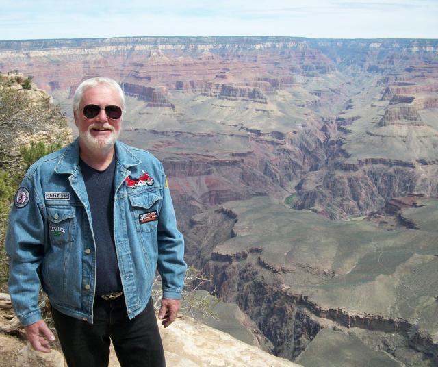
Over the three balmy days and two frigid nights I was able to wander by bike and on foot along the South rim I learned much about history and geology and archeology… and about safety. You’ll notice there is no fence or guardrail behind me in this picture. In truth, miles of the canyon rim are unobstructed, unprotected, and easily accessible to tourists. I was amazed we don’t read about dozens of fatal accidents every year at this park. Most tourists come here to the South Rim; there’s also a popular vantage point on the North Rim, a long ten miles across the gorge (an even longer 215 miles by car). Clearly, the canyon’s five-million annual visitors (in 2010)–from all over the world–deserve a lot of credit for their care and caution for their own safety.

In my prowling of “The Village” I happened into the Grand Canyon Gift Shop where I was stopped by a small group of fellow tourists and asked if I would autograph an informational pamphlet they were about to buy. The mix up arose from a photograph of the author on one of the pamphlet’s pages featuring him with his daughter. The resemblance was close enough that for a moment there, even I was confused.
Grand Canyon to Hoover Dam: (A change of plan)
A couple of pages ago, on my route map, I indicated a plan to travel northeast from The Grand Canyon to visit Monument Valley and the Navajo Tribal Park at the Utah line. But in fireside chats with other campers at Grand Canyon I was impressed by their colorful descriptions of Death Valley and the sad insufficiency of my planned single day there later in my trip. Also, after a series of three one-night stands at the start of this tour, my leisure, two-day stay at the Canyon convinced me that I needed to slow down and smell a few more roses. And my campfire consultants were quick to point out that I was destined to see plenty of rock formations and desert spectacle at the other destinations along my route. So in order to buy some time down the road, I decided to forgo the planned northeast detour to Monument Valley and to head west, instead. The next morning that’s just what I did.
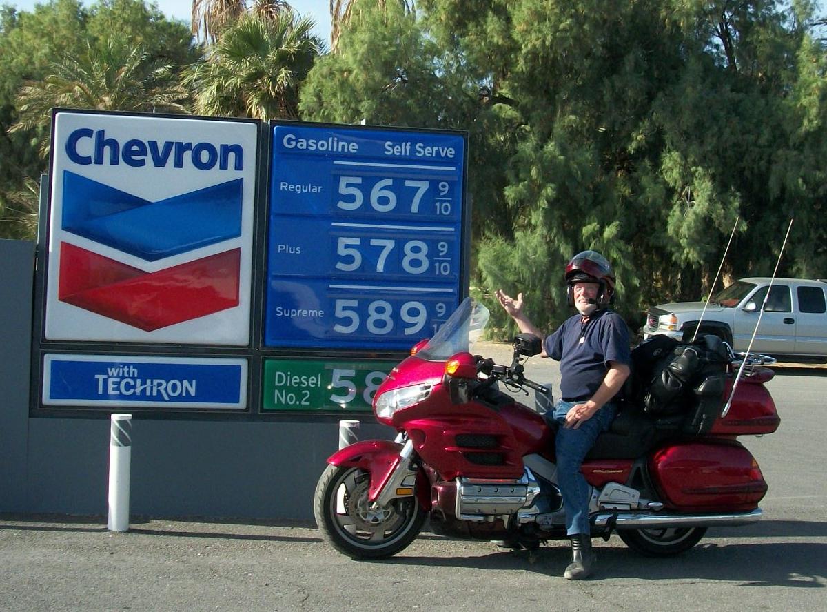
(Day 6) I rode fifty miles due south from the Canyon on Saturday to intersect my favorite wind tunnel–Interstate 40–and then turned west for 120 miles to Kingman. It was an afternoon ride, so I expected the worst, but I encountered no punishing winds. I ate a quick and early supper before turning northwest on U.S. 93, trying to beat the darkness to Hoover Dam, just 80 miles away. But the sun had long set before I breezed right by the dam without ever seeing it. (I’ll explain that unexpected experience in a moment.) I continued on Rte. 93, which curved to the west, and soon I rolled into nearby Boulder City, where workmen lived for more than five years as they poured four-million yards of concrete into the dam’s construction. It was too late to look for a campsite, so I settled in at a great, old, mom-and-pop (read that as cheap) motel.
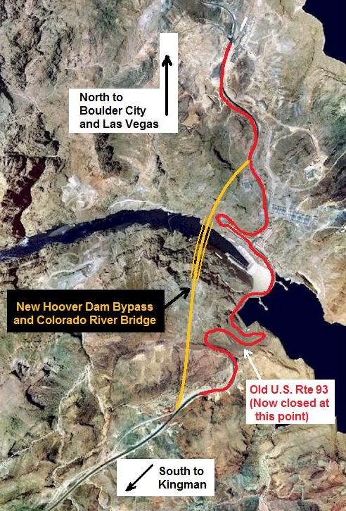
(Day 7) It was Saturday. I woke up rested and refreshed, had breakfast, and got back on U.S. 93. I wanted to retrace the route I had used years before to visit Hoover Dam from Las Vegas. In those days U.S. 93 (in red on the map) was the only eighty-mile road between Boulder City and Kingman, and it was a twisty, snarly two-lane mess at the always congested dam.
Not anymore.
Six months before my 2011 visit, progress caught up with that nightmare of slow-moving miasma in both directions. That old U.S. 93 is now blocked just south of Hoover Dam. (See map). In fact, it is no longer called U.S. 93. It is simply called the Hoover Dam Access Road, and that’s all it’s used for—tourist travel and service access to the dam… and only from the north.
In 2010, a new Hoover Dam Bypass was opened near Boulder City that now provides a four-lane, straight-line, elevated route across Black Canyon and the Colorado River at the dam. The highspeed motorway reconnects with the old four-lane U.S. Rte. 93 a mile and a half southeast of the dam and continues to Kingman.
The Hoover Dam Bypass

A masterpiece of highway engineering and traffic management (yellow on the map) now soars over the swirling waters below Hoover Dam. The Colorado River Bridge at Black Canyon was five years in the planning and building. It’s well downriver from the face of the giant power station, and that explains why I didn’t see it in the dark last night on my way north. I had no idea I had been shunted onto the new Rte. 93 bypass artery, and that I would not be driving across the dam. From the distant bridge, even in daylight you get only the briefest glimpse of where the dam might be, and sneaky peek is available only in the northbound lanes to Las Vegas. Except for road signs, southbound travelers get no visible clue the colossal landmark is just a quarter-mile away.

For 75 years before my 2011 visit to Hoover Dam you couldn’t get this picture. The Colorado River Bridge at Black Canyon (five years in the making) was not yet open. Now that it is, you can hike up to its pedestrian walkway, 1500 feet south of the dam, and shoot the kind of photos of the structure that previously were possible only from a drone. When I rode across this bridge last night, the darkness and the tall bridge railing kept me from seeing the colossal Hoover Dam to my right.
LET’S GET A CLOSEUP LOOK: Return to the map above, and notice the section of old Rte. 93 just north of the dam–the section with the sharp, red hairpin curve that extends right under the big, new bridge.
Next… imagine yourself driving south from Boulder City and just approaching that hairpin switchback. The dam is ahead on your left, and the new bridge crossing the Colorado River at Black Canyon is on your right. Now… Click the link below to make that ride.
VIDEO:
Approaching Hoover Dam from the north … Las Vegas.
Las Vegas, NV: (A jackpot of trouble)
Before I left for Hoover Dam on Saturday morning I had told the motel manager I would like to keep my room for another night. It was equipped with a fridge and microwave, comfortably furnished, and it being Easter weekend; I thought I’d take a holiday. It turned out to be a fortuitous decision. After visiting the dam, I returned to Boulder City for lunch and decided to spend the afternoon in Las Vegas, just 25 miles away. I did the obligatory tour of the main drag through casino canyon, posed for a couple of touristy photos, and remembered all the reasons I’m not one of the big fans of Sin City. (Click photo to Enlarge)

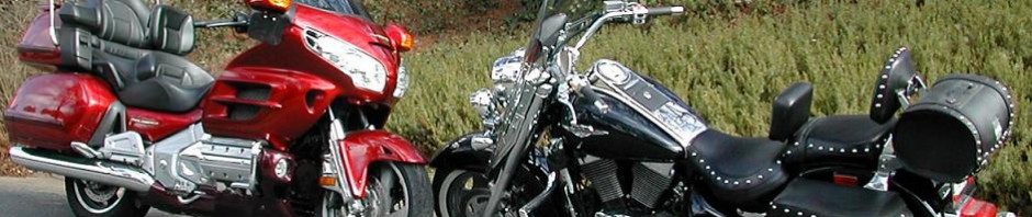
It was on the ride back to the motel that I got the feeling something was wrong. As I took the ramp onto I-215, Scarlet displayed an uncharacteristic skittishness in her footing on the highway. Now that I focused on it, I could feel it clearly as I leaned the bike into each sharp curve or turn. When I got to the motel I gave Scarlet some time to cool down while I walked over to a grocery store, and when I got back I hoisted her up onto her center stand so I could spin her wheels and inspect her tires. Not good news. The rear tire was beginning to show uneven wear, called cupping. I’m sure I’d allowed it to happen by not closely monitoring tire pressure as I should have, and I doubt the side forces from days of crosswinds and hundreds of miles of twisties had helped very much either. In any event, this was not the tire on which to plan a further two thousand miles of riding. It would have to be replaced. Did I mention it was Saturday evening on Easter weekend?
I cranked up my Toshiba netbook and accessed the motel’s WiFi connection. Then I posted SOS messages on the two chat boards I enjoy most frequently online. I explained that I was leaving the next morning for two nights of camping in Death Valley and would probably be out of internet and cell phone contact. I was surely out of luck for Easter Sunday and Easter Monday, anyway, so I asked if anyone could act as my agent and book me into a dealership or service facility to have a new tire installed as I passed back through the Las Vegas area on Tuesday. It was asking a lot–tracking down the appropriate tire and booking a service appointment for a third party. But this is precisely the kind of off-the-wall experience that makes these website chatrooms so important to motorcyclists.
Within a couple of hours I had a message from an administrator on the GL1800 Riders discussion board. He was half a country away and couldn’t help me, but he gave me a list of Gold Wing owners in my immediate area, and he suggested that I call one of the group’s more active member who just happens to live in Boulder City. I got hold of Matt Sheen on Sunday morning, and that’s when the biker gods started to smile on me. Matt had just recently removed a nearly new, rear tire from his Gold Wing as part of a new riding configuration. The tire was still at the service shop, and he would make arrangements for his mechanic to put the tire on my Gold Wing on Tuesday. He told me to go ahead with my Sunday trip to Death Valley and he would take care of the details before he, himself, left on a motorcycle trip the next morning, headed for Yosemite. He would leave voice mail on my cell phone describing the final arrangements.
Boulder City, NV to Death Valley, CA:
(Days 8 & 9) I was able to put the tire incident completely out of my mind for the next two days. I rolled out of Boulder City and looped south of Las Vegas for the short, 140-mile run to the land that God forgot. There were complex motivations in adding this destination to my itinerary. First, when Bryan Cady was describing his western trips to me, it was the mention of camping below sea level in Death Valley that stuck most vividly in my memory. There was a magic to the concept and a challenge in the notion of intentionally going–and staying–in a place bemoaned for its inhospitable and often deadly environment. And also I wanted to add California to the list of states I have been able to visit on two wheels.
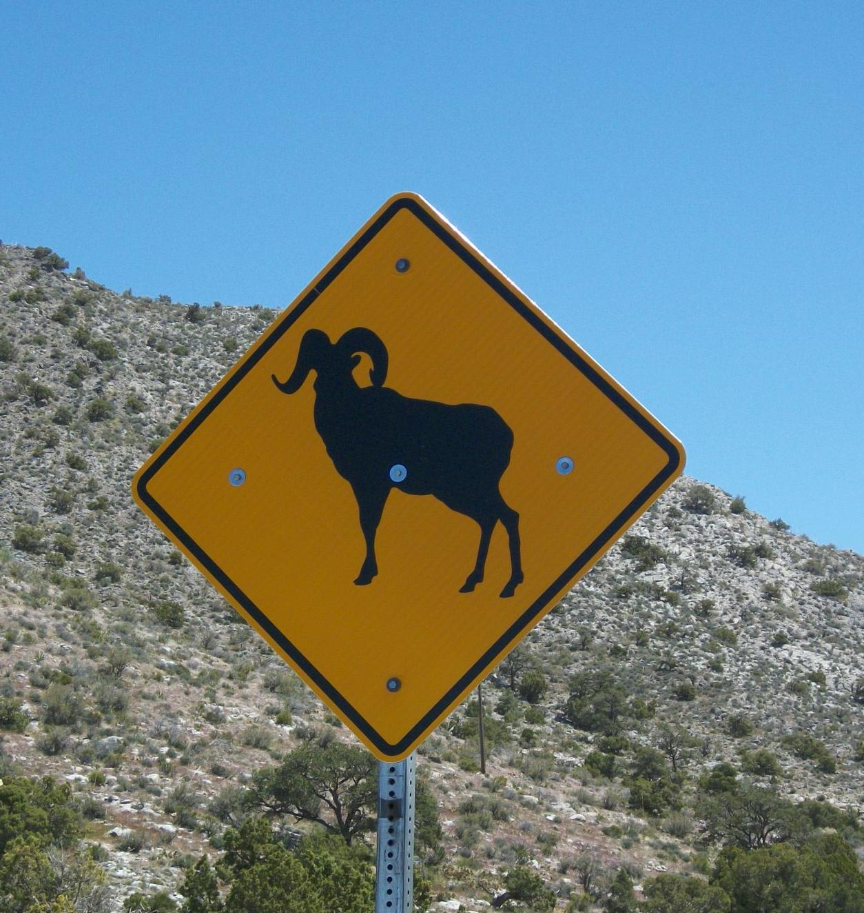
Almost immediately, the landscape around me started to take on new, wilder, even drier characteristics. Crossing the spines of some rugged mountain ridges, the roadsigns reminded me that this was terrain I had never before experienced, and it was home to critters of sizes and shapes we don’t share space with back home. Mostly I was struck simply by it’s unwelcoming, unforgiving personality, an assessment that was reinforced each time I saw a warning that motorists “should not wander off the marked roadway.” And it would get harsher still.

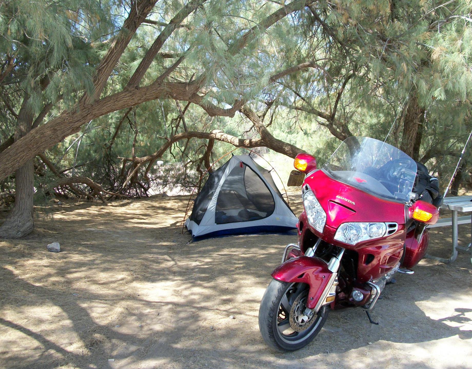
There was no need for a reservation this early in the year at the Furnace Creek Campground in Death Valley. This is not a venue that attracts the masses I encountered at Grand Canyon or at Arches National Park, although I really can’t say why. Despite it’s lethal reputation, the deadliest things I encountered in this awe-inspiring area were the merchants who seemed hell bent on getting every nickle I had in my pocket. For a small–I mean smaller than a Campbell soup can–jar of peanut butter I paid $3.50. (Remember: This was in 2011.) Nonetheless, the experience of visiting and riding here remains one of the highlights of my trip. I’ll show you more of it in a moment.
(Click to Enlarge)
I haven’t mentioned the Senior Pass I carry that’s good in all of the country’s national parks. It cost me ten bucks, and it’s valid for life. It gets me free admission (which can run $25 in many parks) and fifty per cent off on campsite rentals. I paid ten dollars a day at Furnace Creek; I had paid the same paltry rent at Grand Canyon, and I would at Arches a week later.
It’s a great investment.
The last two nights I had suffered in my tent had been frosty events at Grand Canyon–before the motel break in Boulder City. And I would face more of those frigid temperatures later as I headed north, but the two nights in Death Valley were the best camping experience of the trip… of many a trip. I didn’t bother to put the rain fly on the tent, and both nights, as the desert breeze wafted through the mosquito netting, I went to sleep in shorts and T-shirt, lying on top of my sleeping bag. At about 4 AM, as the last of the daytime heat bled out of the dry air and the ground, I’d find myself burrowing under the covers to doze soundly ’til well past daybreak. I was glad I had taken the advice of fellow travelers and rerouted myself to enjoy the extra time at Furnace Creek.
Riding in the valley is more spectacular than you might expect. Despite an arid sameness to all its sections, the landscape is spectacular in the harsh extremes it displays around every bend in the road. Again I have to confess that pictures just can’t do it justice. But if you click on the link below, you’ll get a tiny taste of the valley’s desperate beauty.
Video: Click here for a Ride Through Death Valley.
On Tuesday I headed back to Las Vegas, and with luck, I’d be sleeping that night on the shores of Lake Meade, before riding north to the spectacle of Utah’s magnificent national parks. But first, I would check my voice mail to see what sort of tire replacement magic Matt Sheen had been able to weave for me before he hit the road to Yosemite. You can read the rest of that story just ahead at Saviors from the Chaos.

Nothing worse than to have tire problems on a GREAT adventure. Love this trip report!