Recalling Swamps and Islands and the Allure 0f Key West

Among the vestiges of my sailing days is the habit of measuring distances traveled in terms of dramatic mileposts. Mariners of old would label seas not yet sailed with ominous pronouncements that “In these waters there be dragons.” So, too, their last, departing glimpse of terra firma was often marked on their charts with the somber description of “Land’s End.” And in that spirit I titled this page. It’s the image I held in my motorcyclist’s eye during the cold weeks of winter 2010-11 as I planned my next road trip.
In order to escape north Georgia’s seasonal chill as early as possible in 2011 and to regain my days of freedom and exploration, the wisest direction of travel was south. And you can’t go far south from Atlanta before you flat run out of roadways to explore. It became my objective to make a destination of that “dramatic milepost.” I would ride ’til I could ride no more… to land’s end… at least as far as my home nation is concerned. I set my sights on the southernmost point in the USA. I would ride to Key West by way of Lake Okeechobee, The Everglades, and the series of island-linking causeways known as The Overseas Highway.
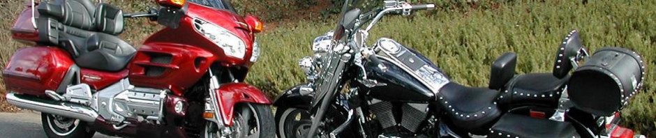
Since neither I nor my wife and riding companion, Delcia, are given to wasting time (retirement time for me, vacation time for her), this would not be an all motorcycle trip. In fact, for Delcia the trip portion wouldn’t be motorcycle, at all. In order to conserve her valuable time off, the solution was simple: “You ride down on the Goldwing, and I’ll fly to Key West to meet you.” There was another factor contributing to her unease. I was planning my trip for the first week in February, and I intended to camp along the way. Almost certainly it would be balmy and delightful at the southern tip of the Keys, on a latitude with The Bahamas and barely fifty miles north of the official tropic zone. But my road pal had better things to do with her vacation days than to gamble them on Florida campsites in midwinter. I would tent my way down to paradise, but we would reserve a nice motel room for her three-night visit.

As for me, I wasn’t deeply enamored of riding the northern half of the route, either. Atlanta to Jacksonville can be a long and dreary trip even in a car. And in early February there ain’t much “balmy and delightful” in Macon or Valdosta. So I compromised; I trailered the Goldwing as far south as Daytona Beach. A fellow Goldwing owner who became a friend through a motorcycle chat board lives not far from there, and he was kind enough to look after my van and trailer for the week I’d be riding in the southern part of his state.
Deltona to Port Mayaca (Lake Okeechobee)
Leaving Jerry’s house on day one of my southward ride made good on the promise of milder weather than I had experienced for my chilly, rainy departure from Atlanta. It would be a short day. I needed to cover only 170 miles to reach my first camping destination, but because I invariably forsake the Interstate highway system in favor of more scenic routes, it was a five hour trip, most of it on U.S. Routes 92 and 441. I rode along the southwest shore of Lake Monroe and bypassed the tourista mega-complex at Orlando. My track past Sanford and Winter Springs and Azalea Park exposed me to a new appreciation for Florida’s unique and harmonious population of disparate cultural groups, a patchwork mix of ethnic, economic, and professional segments. It was interesting and in some cases curious to detect the distinctions among their home enclaves and workplaces. The natives of the Sunshine State were easy to spot. Their homes frequently sat settled and apart in vintage neighborhoods along older, time tested roadways. The fresher, blacktop surfaces usually led to more recent, more colorful, and more manicured retirement communities on lakes or golf courses or both. Immigrant communities announced themselves by their use of color and the language on their business signs. Named settlements were separated by sizable expanses of marshes and wetlands and some generous tracts of farmland.
My route ran almost due south about halfway between the Atlantic coast and the spine of the state. South of St. Cloud, Route 441 carried me parallel to the express lanes from Orlando to the Palm-Boca-Miami Gold Coast. That other roadway is appropriately called Florida’s Turnpike, and as the name implies, it’s a toll road extending 255 miles from Disney World to just past Homestead Air Force Base. If there’s any road type I dislike (and avoid) more than Interstates, it’s toll roads.
So I kept to 441 through a Florida landscape I’d never had time to enjoy before. For 90 miles from Kissimmee to Okeechobee I settled on two fundamental vocabulary words to describe the state’s inland terrain: desolate and beautiful. I was so engrossed in absorbing the sights that I completely neglected to photograph them. I have shamelessly borrowed these images from the State of Florida. (Click on the graphic for a larger view.)

To be sure, there are vast tracts carved out of this eye-pleasing wilderness and dedicated to more productive land management. Herds of cattle, citrus groves, and fields of truck crops dot the landscape all along the way, and that was only what I could see from the highway. The scope of this area’s yield to the marketplace is not something I would want to estimate. One facility that I did find in rare and short supply (probably because of the sparse population to be served) was the basic gas station. After a long and worrisome several miles I was in no position to quibble about price or brand when I rolled up to the pump with nothing in my tank but fumes.
I rode into and through the town of Okeechobee and then south along the eastern shore of the lake bearing the same name. Lake Okeechobee is huge. At 730 square miles, it’s about half the size of Rhode Island. It’s the largest lake in Florida and the second largest freshwater lake lying wholly within the lower 48 states.
Parts of the lake lie in five different Florida counties. But Okeechobee (Big Water in the language of an old Georgia-Florida Indian tribe) is remarkably shallow–less than 15 feet at its deepest point. Outflow from the lake constitutes the headwaters of that River of Grass we know as The Everglades.

My destination was about halfway down the eastern shore of Okeechobee at a place called The Dupuis Reserve. It’s a nature study, hiking, camping, and equestrian facility owned by the South Florida Water Management District and managed by Florida’s Division of Forestry. I chose it as my first camping stop because it was a convenient distance from my starting point… and it was free. There are no formal campsites. Tents are pitched and campers are parked in a tree studded horse pasture at the equestrian center. There are toilets and showers in a low wooden building, and that’s all I was looking for.
Dupuis Reserve to Big Cypress (Everglades)
As scenic, relaxing, and short as day one had been, that’s how lackluster then moderately disastrous and ultimately tiring day two turned out to be. It began with a tedious 45 miles around the south end of Lake Okeechobee, through Canal Point and South Bay to Clewiston. I spent most of that hour dodging overloaded trucks carrying wet sugar cane that set up a curtain of misty, muddy spray from each passing vehicle. It was getting hot and dry as I turned due west across the Florida peninsula. I was thinking if I made good time for the next 70 miles, through Labelle to Fort Myers and Cape Coral, I might treat myself to a walk on the beach and a few seashells at Sanibel Island.

In fact, luck was with me. The miles passed quickly with one stop for fuel and a bottle of water and another for the obligatory bike-in-an-orange-grove photo.
As I left Cape Coral, I was following a well marked route toward Sanibel Causeway Boulevard when traffic ground to a halt… then creeped… then halted again… and again. The afternoon temperature had climbed past 80 degrees, and it appeared every tourist in the state had decided to join me for a stroll on Sanibel’s shell-strewn beaches. I was still a hundred miles from my planned campsite, and I wanted to get there well before dark, which comes early in February. I made a U-turn out of the stalled traffic and headed for I-75. It would mean riding the dreaded Interstate, but only for the 30 miles to get me past Naples and clear of the coming rush hour.
Wearing my heavy, armored riding gear (Click on the orange grove photo above) the day’s heat had grown uncomfortable in the slow traffic. By the time I got to I-75 I had worked up a serious case of damp, and shortly after I rolled onto that concrete ribbon of death, a bad thing happened. Sweat trickled out from under my helmet, sidestepped my eyebrows and rolled into my right eye, carrying with it the sunblock I had applied to my nose and forehead to prevent Rudolph syndrome. The burning pain was intense, even causing the other, unaffected, eye to tear up. In 65-mile-per-hour traffic, avoiding semis and gawking tourists, I was suddenly looking at the roadway as though we were all underwater. And the pain was a significant distraction from my ability to concentrate on my riding technique. I managed to grope my way to the right shoulder of the highway, stop the Goldwing, and dismount. I grabbed my handy squeeze bottle of drinking water and emptied it into my right eye as I scrubbed with my handkerchief to keep further contaminants out of the fire site. It alleviated the cause of my distress, but not the pain itself. I got back on the bike, and at the next exit I was lucky enough to find a pharmacy where I could buy a bottle of soothing eye drops.
I abandoned I-75 as planned at Naples and turned south to intercept the Tamiami Trail, which happens to be U.S Route 41, which happens to pass within three miles of my house in Georgia, 650 miles to the north. In other words, I could have gotten on Cobb Parkway (U.S. 41) in Marietta and followed it to the same spot I was approaching. The Tamiami Trail (pronounced TAMM-ee-AMM-ee) runs east-west across the heart of The Everglades from Naples on the Gulf coast to Miami on the Atlantic. It’s a level, straight, and beautifully maintained stretch of highway with water-filled ditches on both sides and a constant threat of crossing wildlife to keep drivers alert. It’s the only stretch of road I have ever ridden on which signs warned me to be watchful for both deer… and panthers. That’s enough to keep you alert even after you’ve left The Trail and settled into a flimsy nylon tent for the night.
The Big Cypress National Preserve isn’t officially part of the Everglades National Park; the land itself wasn’t owned by the federal government when the park was formed in 1947. So now that it is owned by Washington, Big Cypress is its own administrative locale for reasons that elude everyone but the feds. Trust me, when you’re in Big Cypress… you’re in The Everglades. There are six Big Cypress campgrounds, five of which are open all year round. My selected destination was the Midway site, 65 miles from Naples. I pulled in well before dark and discovered the stark reality of camping in Florida: it’s always crowded. If I had been in an RV I would have been out of luck. The 26 RV sites were booked solid, and the tent site I claimed was the last of the ten available in the campground. I saw that as a sign my luck was on the upswing after my fire-eye experience of the afternoon.

As I emerged from my tent on day three I wondered if I’d been too quick to count my lucky stars. The omen of the last tent site faced stiff competition from the spectacle that greeted me in the morning sun. Just across a small pond from my tent, five uninvited guests were awaiting my morning appearance. Perched in the branches of a leafless tree and gazing balefully in my direction was a gathering of vultures… you know, buzzards… with a disconcerting interest in my plans for the day. When you’re barely a month shy of your sixty-ninth birthday you tend not to take lightly a pre-breakfast visit from a flight of scavengers with an appetite for roadkill. It makes you wonder what they know that you don’t. And it makes you think yet again about loading your calcium-depleted bones onto a motorcycle.
Big Cypress to Long Key
Traveling eastward on The Tamiami Trail will eventually take you into the most southern extremity of Florida’s east coast metroplex… just below Miami. I spent day three wending my way still farther south, toward Homestead, where I could intersect U.S. Route 1 and follow it over the causeways and through the Keys. It was in this area of extreme southern Florida that I discovered where all those tropical plants come from–the ones you see for sale in supermarkets and at roadside stands in more northern climes. They were being cultivated in orderly rows that covered hundreds of acres along Route 1.
I had been warned that prices are high in Key West (practically everything has to be trucked in), so I made a stop at a Walmart to stock up on some essentials. Then it was just a matter of pointing the bike down Route 1 and watching the exotic island names flash by: Key Largo, Plantation Key, Islamorada. I have some video of the ride. It’s a bit shaky because I mounted the camera on the windshield where it felt the worst of the road bumps. But if you click on the link, you’ll see a compressed version of some of the ride on The Overseas Highway. (Click Here for Video. Then click the image to START.)
I could have ridden all the way to Key West; it was less than 200 miles from my Everglades campsite. But I was a full day ahead of Delcia and her flight from Atlanta, so I decided to try my luck at a couple of state park campgrounds. I stopped first at Long Key, and despite the omen of the buzzards, fate smiled on me again. I spent the night on the shore of the Atlantic, as you can see in the photo at the top of this page and enjoyed my morning coffee to the sounds of seabirds and lapping waves.

Day four found me with fewer than 70 miles to cover. It was a casual and beautiful ride over more causeways and sandy islands. I arrived in Key West in the afternoon and located our quaint, little motel within easy walking distance of Sloppy Joe’s and all the other attractions on Duval Street. I unloaded the bike, explored the town a little, made a quick run to a supermarket for snacks and drinks, grabbed a long, hot shower, and arrived at the Key West Airport right on time to offer Delcia a warm and sweet-scented, moonlight ride to our island hideaway.
Long Key to Key West
Florida, as you might know, is a state with no requirement of a helmet for motorcyclists.
I swore I would never take advantage of what I deemed such lax standards for safety.
In fact, when Delcia and I rode to Charleston and Myrtle Beach in South Carolina (also a helmet optional state), we wore our hard hats every day. But the speed limit all over the island of Key West, as far as I could tell, doesn’t exceed 35 mph. And a sizable segment of the local population rides either motorcycles, motor scooters, or bicycles. Everyone is alert to them and accustomed to sharing the road with them. In addition, there is an amazing assortment of conveyances of every type on the streets of the town– small electric cars, pedicabs, motorized street cars, tour buses. The pace of the traffic, like the pace of living, in this sleepy resort puts a whole new face on the issue of vehicular interaction. Delcia and I both ended up leaving the helmets in the motel room after just a day on the streets.
I shot a video that lets you try to spot some of the esoteric modes of transportation in the town. Just click on the link to check out the Many Ways To See Key West.

We had a fantastic three days in Key West. We watched the sun go down (along with 400 other tourists) at Mallory Square…
(Click to enlarge)

We discovered the savory delight (for former smokers only) of hand-rolled cigars, fashioned before your very eyes by an ancient Cuban artisan…
(Click to enlarge)
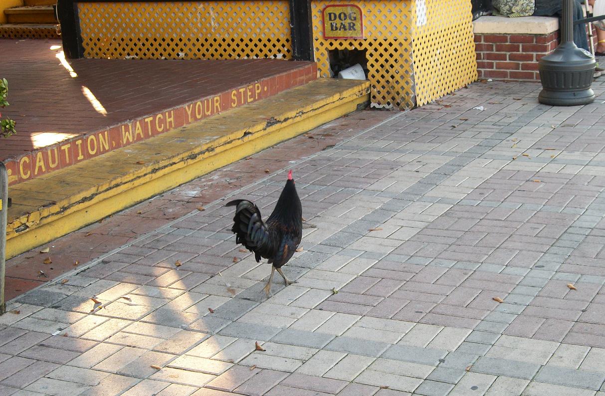
We marveled at the free-range chickens that wander the town at their leisure (they were set free when cock fighting was outlawed, and since Key West is a bird sanctuary, they cannot be molested).
(Click to enlarge)

We even succumbed to the attraction of the glass-bottomed boats and ventured out onto Key Wests barrier reef.
(Click to enlarge)
xxx
xxx
And we actually saw one of the legendary seven-toed cats that stalk the island, but the camera-shy little bastard disappeared before I could snap his portrait.
Both of us have vowed that we will go back to Key West. I don’t think I’ll ride the bike next time. I’ll follow the lead of my bride and let Delta handle the travel chores. We can rent a pair of motor scooters and not have to ride two-up as we did on this trip.
I won’t take any more of your time to chronicle the ride home. I have to say that the 124 miles of causeways that proved so interesting and such a challenge on the way south weren’t quite as much fun on the way back home… just too much of a good thing, I guess.
And… Oh!!! One last note on the title of this page. I want you to know I lived up to it.
And I have the pictures to prove it.


Excellent excursion! It’s one I plan to undertake myself before too long. I won’t have the same distance to cover as I’ll depart and return to Tampa, but the trip and the remaining road to be shared looks fantastic. Thanks for the videos and the buzzard warning!
hi, im Eddy just played with you on cod, and read a
few paragraphs on your journeys very nice, biking is wonderfull ,nothing is more satifying…….