Pueblo to Santa Fe:
The winds I experienced as I rode south from Pueblo, Colorado, were not a momentary phenomenon; they strengthened and stayed with me for the first four days of my loop through six states. I didn’t have an inkling of that prospect until the next day, so I’ll save that revelation for tomorrow’s entry.
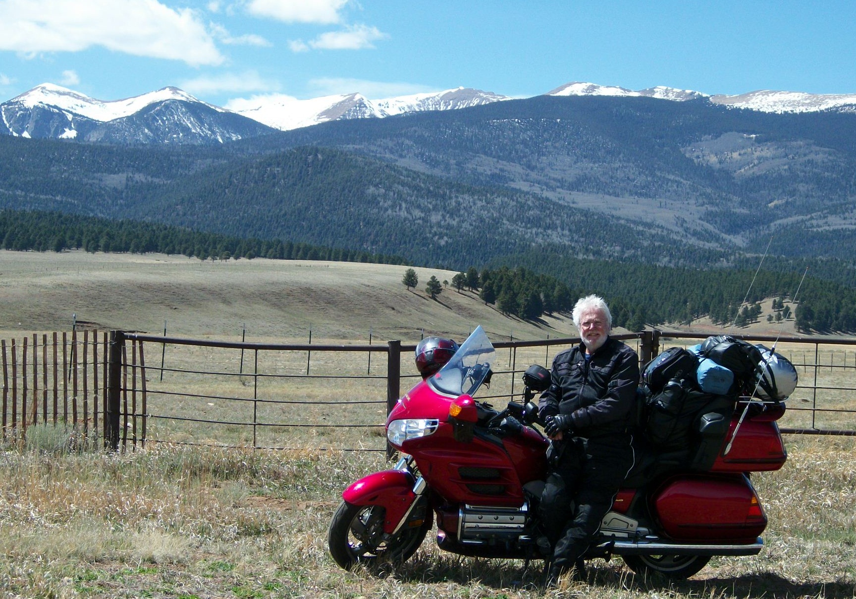
I did get some occasional shelter from the squalls of Colorado after I crossed over Raton Pass and into the valleys of northern New Mexico. I was hit only occasionally by episodes of dangerous gusts. Unfortunately, those occurred on steep, twisty roadways at higher elevations, first around Cimarron and Angel Fire, and then on the upper peaks along The High Road to Taos.
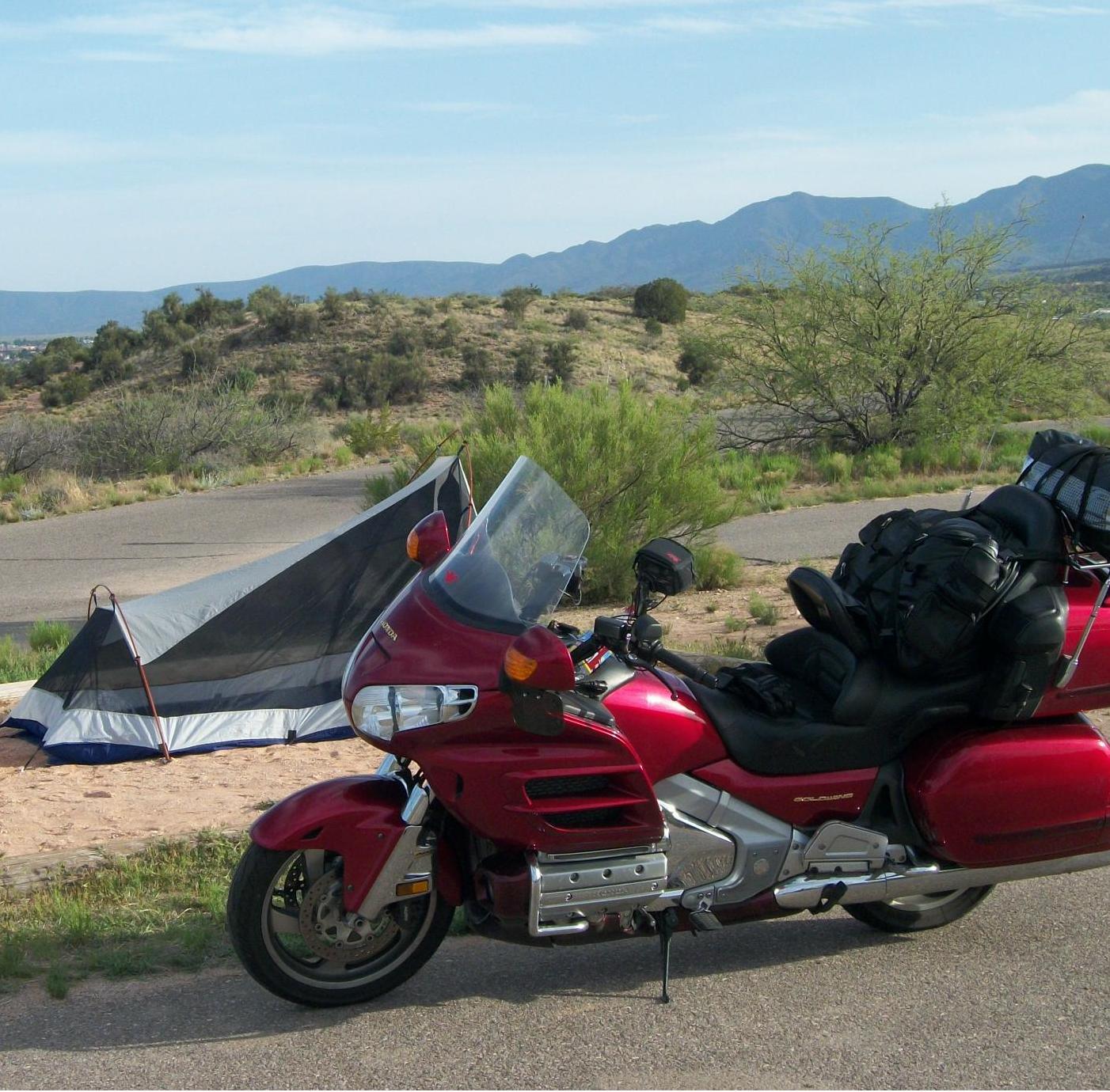
To be more precise, on my chosen track, it was The High Road from Taos. The ridge-running motorway gets its name from its path northward out of Santa Fe and up to the World Heritage Site in the Sangre de Cristo Mountains. The town has been a thriving artists’ colony since the ninteenth century, and its adjacent Taos Pueblo has been occupied consistently since it was built centuries before Columbus. I followed The High Road from Taos southward to Santa Fe and enjoyed it immensely, arriving in New Mexico’s lovely and sedate capital just in time for a quiet dinner. I then made the simplest of campsites at Hyde State Park, and took my road weary bones to bed.
Santa Fe to Show Low, AZ:
(Day 2) I knew that, at 330 miles, this was the longest riding day planned into my three-week itinerary, so I tried to get an early start after a mediocre night’s sleep in the mummy bag. I ramped up onto nearby Interstate 25 and looped southward to and through Albuquerque. It started as a comfortable ride in cool, morning air, and I gave little thought to yesterday’s turbulence.
The first gusts hit at mid-morning as I was dodging herds of tractor-trailer trucks and traffic-weaving tourists, and just as we approached the labyrinth of lanes that would shunt us from southbound I-25 to either east or west on I-40. By the time I had made that transition–headed west on the new highway–the warming, desert air was showing off its energy. Yesterday’s westerlies had veered into the north, and every 35 mph blast from my right threatened to push me out of the slow, right-hand lane and into the path of the giant trucks passing in a steady stream on my left. And each of those behemoths produced a wall of wind that hammered me from that side.
I fought the forces of man and nature for fifty miles, always tense, often frightened, and then finally… terrified. I was hit simultaneously by a powerful wind blast from the right and what I have to call the shock-wave off the front of a truck passing on my left. The resulting convergence of forces felt as though they lifted Scarlet’s wheels right off the highway. This is a 900-pound bike with a 200-pound rider and another 150 pounds of gear piled aboard, and I felt like a puny second-in-command of its direction.
I peeled off at the next exit ramp, labeled Laguna, and gratefully found myself in a crossroads village populated by members of the Laguna tribe of the Pueblo people. They operate a modern and well stocked general store/gas station, and the place is the home of the “World Famous Laguna Burger.” I opted for an apple and a bottle of water and sat down on the front porch to wait for my blood pressure to come down.
The road where the store is located appeared to run parallel to the I-40 I had just escaped, so I toyed with my GPS until it became clear that this was, indeed, a portion of the famous, old Route 66. I went in to talk with the store clerk, and he told me, yes, I could follow 66 the remaining 32 miles to Grants, NM, where I was scheduled to turn south off of the I-40 suicide highway. He also disabused me of any optimistic forecast I might entertain where the winds were concerned. I asked if I could expect them to calm down in the next day or two. “Can’t imagine why,” he scoffed, “been blowin’ like this for a month now.”

(Click to ENLARGE)
Compared to the hellish I-40 ride from Albuquerque, Route 66 to Grants was only blustery, and I was able to enjoy the serendipity delight of the fabled highway. At Grants I turned south and west to head across the tribal lands of a number of native American peoples and thought I would never reach the other side. This is intended as absolutely no reflection on the tribes involved, but rather a commentary on the vastness of their domains. Visions of sun-bleached skulls in the desert–one of them mine–passed before my weary eyes as I rode mile after brutally wind-swept and arid mile across New Mexico and into Arizona.
I was headed for the campground in a park and recreation area in Show Low, Arizona, and I know you’re not going to let me breeze past that town’s name without some effort to explain it, so here goes: Legend has it that sometime late in the 19th century two rivals for leadership in the town (established in 1870) decided not to shoot it out on Main Street but to trust their competition to the turn of a card. The one who could “show low” would win, and the other would leave town. The winner reportedly turned a deuce. Hey, I’m as big a sucker for a good yarn as the next guy, and this is where I was going to spend the night. Besides, it was an excellent jumping off point for the next day’s ride to Winslow and Sedona, and Cottonwood… other towns with names to stir the imagination.
Show Low, AZ to Cottonwood, AZ
(Day 3) Leaving Show Low, I could sense a Tuesday that was developing as the most exciting day of my Southwest tour. I was still naive to the majesty of the region and unaccustomed to finding visual and cultural surprises around every turn. So this ride through a kaleidoscope of villages and towns and steep walled canyons–with only limited wind exposure–could truly set a standard for the weeks to come. (In the end, the Most Exciting Ride was still more than a week away when, from the northernmost extension of my trip, I raced southward ahead of a late-season snowstorm that was chasing me toward Moab, Utah, and Arches National Park.) But on day three nothing had prepared me for the rush of enlightenment this eastern cracker was about to enjoy. Here we go.
North of Show Low I stopped to buy breakfast at a supermarket in the unlikely named town of Snowflake. I picked up fruit juice, yogurt, pastry, and the daily banana (every day for the heart-healthy potassium), and I sat on a bench out front to watch the townsfolk filter in and out. I sat, shaded from the high desert’s morning sunshine, and saw segments of the U.S population I had never encountered before… a dressed-alike couple in plaid flannel shirts and dirty jeans and boots so run-over they looked like they hadn’t been off those feet in years… a leather-brown face over a dusty John Deere T-shirt and a belt buckle the size of a hub cap. A parade of locals arrived and left in pickup trucks of inestimable vintage. Then came the medical professional in crisp, clean scrubs driving a late model VW Beetle. She must have been from a doctor’s office because there’s a McDonald’s in the town of 5,000+ but no hospital. Snowflake is best known for its UFO sightings… and at least one reported abduction. When I spotted a teen-aged supermarket employee retrieving a string of shopping carts from the parking lot, I said, “I expected to see girls like you rounding up cattle, not market buggies.” She laughed and said, “Wrong girl, sir; I’ve never sat on a horse.”
There were long stretches of road construction in the 30 miles between Snowflake and my return to I-40 at Holbrook. Strictly controlled traffic and reduced speed limits turned out to be blessings that gave me generous opportunities to appreciate the landscape and occasional wildlife around me. It was still early when I turned onto the Interstate, and the winds had yet to build to lethal velocities for the 35-mile run to my next stop.

In Winslow I paid homage to one of the great bands of my lifetime and then continued west to Flagstaff. It’s only sixty miles, but the mistral was back, and the ride took well over an hour. After that, just a few miles south of Flagstaff, I found shelter in the shadows of deep canyons as I rode toward the Red Rock country that’s home to Sedona, AZ.
Video: A magnificent canyon ride south to the Red Rocks of Sedona.
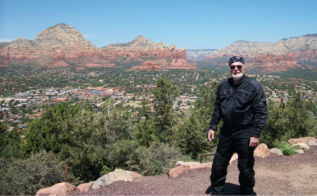
Now I felt the magic of the region. I never knew if the next hilltop or curve would reveal a scene from a John Wayne western or from the pages of National Geographic. Rock formations–towers, buttes, monoliths–stood in defiance of the desert flatlands, both in stature and in color. I had crossed the harsh threshold of challenge to savor the spectacle of my reward.
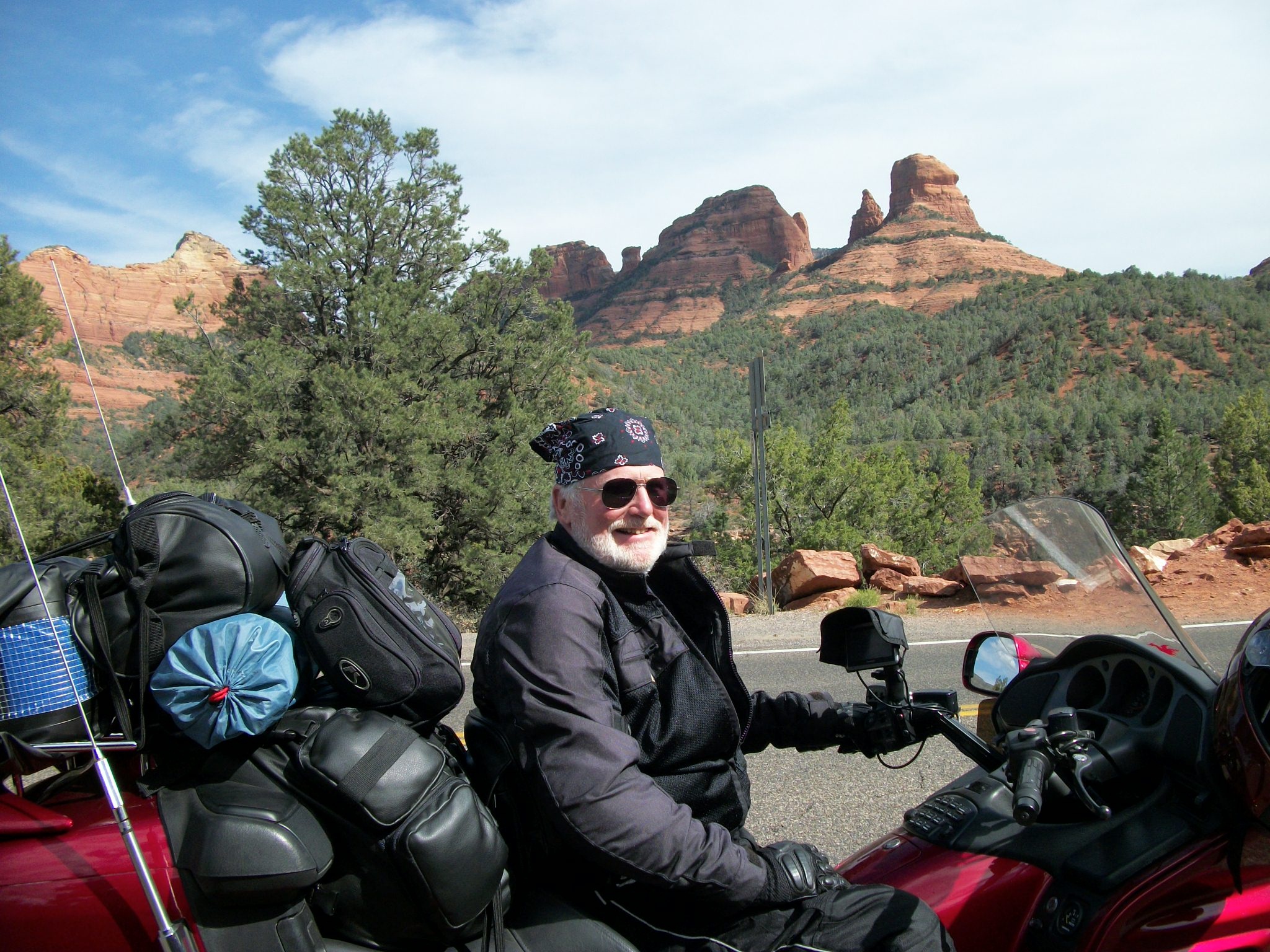
Sedona comes as a bit of culture shock to the first-time visitor. After days of passing through one dusty, vegetation-deprived town after another on the long ride across New Mexico and Arizona, I rode into a charming, landscaped, community of upscale shops and restaurants and plush family homes in tree shaded neighborhoods. All around it rise watchtowers of the red rock that gives the area its name.
My campsite in nearby Cottonwood at the picturesquely named Dead Horse Ranch State Park was comfortable and located among chatty neighbors… especially the young ones unaccustomed to motorcycles in their midst. Despite it being so early in the season, at nightfall the camping area was booked solid; both the tenting grounds and the huge RV sections were full to capacity. By arriving late in the day and with no reservation, I proved to be the last of the lucky campers. (Click to ENLARGE)
I should make one more point before moving on to the next page in this memoir. I have called the segment you’re reading High Plains Rider, and after I rode south out of Colorado and into the furnace of the real southwest, you might have thought that title misplaced. So I want to share with you a startling lesson from my southwest tour. With the exception of Sedona and Cottonwood, all of the locations described on this page are actually higher in elevation than Denver, Colorado. Flat, arid, desert landscapes they might be, but they are closer to heaven than you might ever have imagined. Denver justifiably boasts of its mile high status at an official elevation of 5,280 feet. But Albuquerque tops Denver by 30+ feet (5,312 ft). My panic rest stop in Laguna, NM, was more than 500 feet higher (5,807 ft). Show Low (not “low,” at all) is almost a thousand feet higher than Denver (6,213 ft). Flagstaff is 1600 feet higher up (6,910 ft). And Santa Fe soars almost two thousand feet above The Mile High City at 7,260 feet. It was clear as I rode south out of Flagstaff and toward the Red Rock Country that the steep canyon roads were carrying me to lower elevations. I passed briefly among woodlands and rolling streams that were a welcome relief after the sparse landscapes to the north. But beautiful, classy Sedona (4,326 ft) and peaceful, laid-back Cottonwood (3,314 ft) are both thousands of feet higher than my home port of Atlanta, and I extend my High Plains status to them, as well.
This would be the southernmost limit in my southwest loop. Tomorrow –day four– I would turn back to the north and begin a series of greatly anticipated visits to some of our country’s notable destinations. I hope you’ll read on in American Landmarks.
